


les sables

PhilippeC54
User
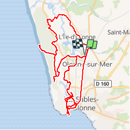

Length
51 km

Max alt
30 m

Uphill gradient
309 m
Km-Effort
55 km

Min alt
-2 m

Downhill gradient
309 m
Boucle
Yes
Creation date :
2017-09-06 00:00:00.0
Updated on :
2017-09-06 00:00:00.0
6h28
Difficulty : Very easy

FREE GPS app for hiking
 SityTrail
IGN / Geographical institutes
SityTrail Plus
The world is yours!
About
Trail Cycle of 51 km to be discovered at Pays de la Loire, Vendée, Les Sables-d'Olonne. This trail is proposed by PhilippeC54.
Positioning
Country:
France
Region :
Pays de la Loire
Department/Province :
Vendée
Municipality :
Les Sables-d'Olonne
Location:
Olonne-sur-Mer
Start:(Dec)
Start:(UTM)
594171 ; 5155181 (30T) N.
Comments